3. Integrating new GeoServer layers into Union VMS application
- Hugo Martins
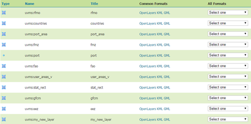
After publishing your new layers, in the Geoserver admin page select “Layer preview” and you will see a list of all available layers.
To integrate this new layer in the Union UVMS application you will need to directly connect to the spatial database shipped with Union VMS and insert a new row in the “service_layer” table. For the current example you would need to insert the following values:
| Attribute Name | Example Value | Additional Note |
|---|---|---|
id |
| Automically generated |
name | My layer | The name of the layer as it will be displayed in the application. Mandatory. |
layer_desc | My new layer | The layer description as it will be displayed in the application. Not mandatory. |
provider_format_id | 2 | In the current release only WMS is supported. The value 2 indicates the application that this layer is a WMS. Mandatory |
service_url |
| If the layer is being provided by your Geoserver installation you should leave this field empty. If you are adding an external WMS layer, then you must provide the base WMS url of the external map server here (e.g. http://external_address/wms) |
geo_name | uvms:my_new_layer | The name of the layer as specified in the map server. Mandatory. In your local Geoserver installation refer to the layer list to see which name you should use. |
srs_code |
| The EPSG code of the layer. Not mandatory. |
short_copyright | Some short notice | The short copyright notice as it will be displayed in the application. Not mandatory. |
long_copyright | Some big notice | The Long copyright notice as it will be displayed in the application. Not mandatory. |
is_internal | Y | Either Y or N. Indicates if the layer is being served through your local Geoserver installation. Mandatory. |
style_geom | my_style | The name of the style as it is stored in your map server. This style should only display geometries. Not mandatory. |
style_label | my_style_label | The name of the style as it is stored in your map server. This style should only display labels. Not mandatory. |
style_label_geom | my_style_label_geom | The name of the style as it is stored in your map server. This style should display geometries and labels. Not mandatory. |
subtype | additional | Newly added layers should always be classified as additional or background. If additional, it will be possible to add the layer in UnionVMS as additional cartography or as a background. If background, it will be possible to add the layer in Union VMS only as a background. Mandatory. |